
GPS vs GNSS: What's the Difference and Why Do Modern Trackers Use Multiple Satellite Systems?
Understand the difference between GPS and GNSS and discover why modern trackers use multiple global navigation satellite systems for greater accuracy, availability, and reliability.
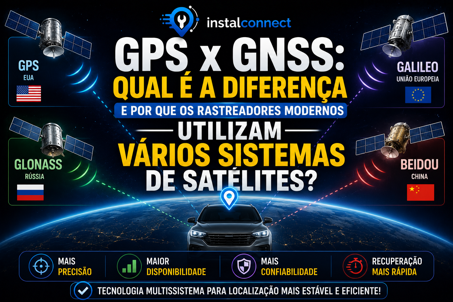
When researching vehicle tracking, it's very common to find the terms GPS and GNSS used as if they were synonymous. While related, they don't mean exactly the same thing.
In practice, GPS is just one of several global navigation satellite systems currently in existence. Modern trackers leverage signals from multiple such systems to offer greater accuracy, availability, and stability in vehicle location.
In this article, you will understand what differentiates GPS and GNSS, learn about the main systems used worldwide, and discover why this evolution represents a great advantage for tracking companies and users.
What is GPS?
GPS stands for Global Positioning System.
It is the satellite navigation system developed by the United States.
For many years, it was practically the only technology used in navigators and trackers.
Even today, it is one of the most important systems in the world.
What is GNSS?
GNSS stands for Global Navigation Satellite System.
Unlike GPS, GNSS is not a specific system.
It is a term used to represent the set of existing global navigation satellite systems.
In other words:
All GPS is part of GNSS, but not all GNSS is GPS.
This is the main difference.
Which systems are part of GNSS?
Currently, the main global systems are:
GPS
Developed by the United States.
GLONASS
System developed by Russia.
It has global coverage and complements GPS in various regions.
Galileo
System created by the European Union.
It was developed for civilian applications and offers high precision.
BeiDou
Navigation system developed by China.
In recent years, it has become one of the largest global positioning systems.
Why use multiple systems simultaneously?
Imagine a vehicle traveling on an avenue surrounded by tall buildings.
Some satellites may be temporarily blocked.
If the tracker relies exclusively on GPS, there will be fewer satellites available to calculate the position.
When it uses GPS, GLONASS, Galileo, and BeiDou simultaneously, the number of visible satellites increases significantly.
This provides:
- greater accuracy;
- better signal availability;
- greater location stability;
- faster recovery after temporary signal loss.
Do more satellites mean greater accuracy?
In most situations, yes.
The greater the number of available satellites, the better the calculations performed by the receiver tend to be.
However, other factors also influence performance, such as:
- antenna quality;
- antenna positioning;
- environment around the vehicle;
- GNSS receiver quality;
- electromagnetic interference.
How do modern trackers work?
Current equipment typically features multi-system GNSS receivers.
This means they can receive signals from different satellite constellations at the same time.
This feature significantly improves location reliability.
The role of the antenna
Even when using various navigation systems, installation remains fundamental.
A poorly positioned antenna can significantly reduce the quality of received signals.
Good practices include:
- avoiding metallic structures over the antenna;
- protecting the cables;
- following manufacturer recommendations;
- testing reception before final mounting.
GPS and cellular communication are different technologies
Another very common misconception is believing that GPS depends on the internet.
In reality:
- GNSS determines the position;
- the cellular network (GSM, 4G, LTE-M, etc.) sends that position to the platform.
These technologies work together but have completely different functions.
GNSS Applications
In addition to vehicle tracking, GNSS systems are used in:
- precision agriculture;
- aviation;
- maritime navigation;
- georeferencing;
- smartphones;
- logistics;
- rail transport;
- fleet monitoring.
Its use is continually growing across various sectors.
Most common errors
Among the frequently encountered doubts are:
- believing that GPS and GNSS are the same thing;
- thinking that GPS needs internet to work;
- imagining that there is only one satellite system;
- confusing cellular communication failures with GPS problems;
- installing the antenna in inappropriate locations.
Checklist for best performance
Before finalizing the installation, confirm:
✔ Antenna correctly positioned.
✔ Cables protected.
✔ Connectors firm.
✔ Good satellite reception.
✔ Cellular communication working.
✔ Equipment correctly configured.
✔ Tests performed in an open area.
✔ Installation documented.
Benefits of modern GNSS receivers
Using trackers compatible with multiple navigation systems offers several advantages:
- greater positioning accuracy;
- better performance in urban areas;
- greater satellite availability;
- faster recovery after temporary obstructions;
- better reliability for tracking operations.
Conclusion
While the term GPS is widely used to represent any satellite location system, current technology goes far beyond it. Modern trackers use GNSS receivers capable of combining signals from different constellations, such as GPS, GLONASS, Galileo, and BeiDou, providing greater accuracy and reliability.
For tracking companies and installer technicians, understanding this technological evolution is fundamental. In addition to improving the quality of installations, this knowledge helps interpret diagnostics, guide clients, and choose the most appropriate equipment for each application.
Frequently Asked Questions (FAQ)
Are GPS and GNSS the same thing?
No. GPS is a specific satellite navigation system, while GNSS is the umbrella term that encompasses different global systems.
What does GNSS stand for?
GNSS stands for Global Navigation Satellite System.
Which systems are part of GNSS?
The main ones are GPS (United States), GLONASS (Russia), Galileo (European Union), and BeiDou (China).
Can a tracker use multiple systems at the same time?
Yes. Many modern devices receive signals from different constellations simultaneously.
Does using multiple systems improve accuracy?
In most situations, yes. The greater number of available satellites increases location reliability and accuracy.
Related articles
 Tracking Equipment
What is APN and How to Properly Configure a Vehicle Tracker
Learn what APN is, how it works, and how to properly configure a vehicle tracker to ensure communication with the monitoring platform and avoid transmission failures.
 Tracking Equipment
How GSM Communication Works in Vehicle Trackers: Understanding How Data Reaches the Platform
Discover how GSM communication works in vehicle trackers and understand how location information is transmitted from the vehicle to the monitoring platform using mobile networks.
 Tracking Equipment
How GPS Works in Vehicle Trackers: Understanding the Technology Behind Location
Discover how GPS works in vehicle trackers, how satellites determine a vehicle's position, and what factors influence location accuracy.